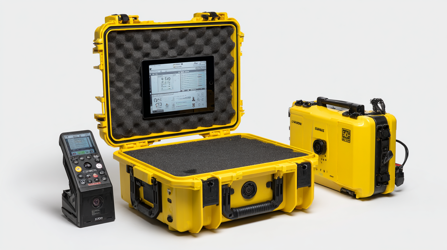
You know, in the fast-paced world of geospatial surveying and mapping, getting accurate measurements is super important, right? This is exactly where the 'Gnss Rtk Complete Set' steps in – it offers incredible accuracy for all sorts of applications.
Here at Shanghai Apekstool (APEKS), we totally get the tough challenges that come with needing precise data, and we’re all about providing innovative solutions to tackle those hurdles. Our lineup of products, which includes GNSS/GPS systems, total stations, levels, and various surveying accessories, is specifically designed to make your surveying projects run smoother and more effectively.
So in this blog, we’ll dive into the juicy details of the top GNSS RTK Complete Set, look at some common issues you might face, and share solutions to help you achieve awesome levels of precision in your work.
Unlocking the Advantages of GNSS RTK Technology in Precision Agriculture Applications
You know, the advances we're seeing in GNSS RTK (Real-Time Kinematic) technology are really shaking things up in precision agriculture. Farmers are now armed with amazing tools that help them boost crop yields and cut down on waste. There’s even a report from the International Society of Precision Agriculture that claims using these precision farming techniques can pump up yields by as much as 15%! That’s huge, right? A big part of this success comes from the spot-on accuracy GNSS RTK provides. It allows farmers to keep a close eye on soil conditions and manage their resources way more efficiently.
One of the coolest things about GNSS RTK in farming is that it delivers that super precise, centimeter-level accuracy in real time. That level of detail is a game changer for planting, fertilizing, and irrigating. It makes sure that every drop is used exactly where it’s needed. And hey, with all the chatter around autonomous vehicles and drones lately, you can really see how essential GNSS tech has become—not just in farming, but in a bunch of industries that need super accurate navigation.
Quick Tip: If you're thinking about jumping into GNSS RTK, you might want to grab some dual-frequency Gnss Receivers. They can seriously up your accuracy and reliability, especially in tricky spots. Oh, and don’t forget to regularly calibrate your gear. It makes a world of difference in performance and helps you really harness the power of this tech. Keep an eye on the latest advances in GNSS technology, too. Staying ahead of the curve is key to keeping your farming practices competitive!
Key Technical Specifications of Top GNSS RTK Systems for Enhanced Accuracy
Alright, so let’s talk about getting better accuracy in surveying, mapping, and all that geospatial stuff. Picking the right GNSS RTK (Real-Time Kinematic) system? Super important! These systems use a mix of satellite signals and ground reference stations to give you super precise measurements—like, down to the centimeter. Pretty neat, right? Now, when you’re looking at these systems, pay attention to the specs because they really make a difference. You want to check out the frequency bands they use, how many satellites they can track, and what kinds of corrections they support. You’ll find that systems working across multiple frequency bands like L1, L2, and L5 can really boost signal strength and accuracy, especially when the environment gets tricky.

Another biggie to consider is the base range, both minimum and maximum. This tells you how versatile the system can be. High-end models have a longer range, which means you can take precise measurements over larger areas without losing that accuracy. And let’s not forget about convergence time—the faster the system fixes its solution, the better it is for you, especially if you’re in a hurry. Systems that can get to the point quickly can really up your productivity, making them top picks for surveyors and mapping pros who want to streamline their work. Really, it’s all about working smarter, not harder!
Understanding Industry Standards and Certification Processes for GNSS RTK Devices
Hey there! So, when you're diving into the world of GNSS RTK devices, it's super important to get a handle on the industry standards and the whole certification process. Why? Well, it's all about making sure that what you're using is both quality and reliable. I mean, with all the cool tech advances we’re seeing—like those shiny new Gnss Rtk Systems popping up for agriculture—manufacturers really need to stick to some tough standards. Thesecertifications? They not only nail down precision but also boost your confidence in what the gear can do, especially if you're into surveying or robotics.
One helpful tip I’ve picked up for picking out a GNSS RTK system is to look for gear that meets those established industry standards, like ISO 26262 if you’re dealing with automotive stuff. This way, you can be sure that the tech can handle safety-critical tasks, which is getting more and more vital in our automated world today. Plus, data security is a biggie too! Make sure you’re checking for systems that come with solid security measures so your data stays intact and confidential while you're using it.
Oh, and don’t forget to keep your eyes peeled for what's new in the GNSS product world. Things are changing fast—think better timing modules and cutting-edge survey applications hitting the shelves regularly. Staying on top of all these new releases can really help you pick out the best tools for what you need, making your projects more efficient and accurate overall.
Comparative Analysis of Digital vs. Traditional GNSS RTK Solutions in Land Surveying
You know, with land surveying changing so fast these days, choosing between digital and traditional GNSS RTK solutions is definitely becoming a big deal. Traditional GNSS RTK systems have been the go-to for surveyors for a long time because they deliver that reliable and steady performance we all count on. But let’s be real here—when it comes to processing speed and keeping up with all this shiny new tech, they can fall a bit short. That’s where digital GNSS RTK solutions really shine. They use cool algorithms and share data in real-time, which boosts accuracy and helps make quicker decisions in various surveying projects.
And get this: the global market for land survey equipment is expected to jump from about 5.25 billion bucks in 2024 to a whopping 7.76 billion by 2032! It really shows how much people are leaning towards digital solutions. These digital systems not only help make workflows smoother but also open the door to a ton of different applications—anything from construction to tracking environmental stuff. With all this high-tech magic, digital GNSS RTK systems give surveyors a level of precision that lets them tackle tricky terrains and tough environments like pros. As the market keeps growing, it’s super important for folks in the field to grasp how these solutions stack up against each other if they want to level up their surveying game.
Unlocking Precision with the Best GNSS RTK Complete Set Technical Specification Insights
| Specification | Digital GNSS RTK Solutions | Traditional GNSS RTK Solutions |
| Accuracy | 1-2 cm | 3-5 cm |
| Operating Range | Up to 10 km | Up to 5 km |
| Data Transmission | Real-Time, Low Latency | Post-Processing Required |
| Battery Life | 8-12 hours | 6-8 hours |
| User Interface | Touchscreen, Intuitive | Button-Based, Less Intuitive |
| Weight | 0.5-1.5 kg | 1-3 kg |
| Cost | $5,000 - $15,000 | $3,000 - $10,000 |
The Future of GNSS RTK: Trends and Innovations Shaping the Industry
You know, the GNSS RTK industry is really on the edge of a big change right now. There’s this cool wave of trends and innovations coming in that are set to take precision and usability up a notch! With so many sectors like agriculture, construction, and transportation craving high-accuracy positioning, manufacturers are pouring a ton of resources into developing new tech. I mean, we’re talking about things like multi-frequency GNSS receivers and tightly coupled inertial navigation systems that are making everything more reliable and efficient. These innovations are letting users hit centimeter-level accuracy, even in some pretty tricky conditions.
And let’s not skip over the whole buzz around machine learning. It’s fascinating how these algorithms can use massive datasets to refine signal processing and cut down on errors from things like multipath effects or the weather messing things up. Plus, the push towards cloud-based solutions is super helpful since it means real-time data sharing and processing—so you get instant updates and stronger network setups. When you mix all these advancements together, GNSS RTK systems are really becoming easier to use, more accessible, and far more effective. Honestly, it’s paving the way for a whole new era of precision and efficiency, especially in surveying and geospatial work!
Unlock Precision Surveying: A Comprehensive Review of the Hot Sale Topcon All Metal Single Tilt Reflector Prism Set
Unlocking precision in surveying has never been easier with the Topcon All Metal Single Tilt Reflector Prism Set. This set is designed to enhance the accuracy and efficiency of your surveying projects, making it an essential tool for professionals in the field. With its robust metal construction, this reflector prism set ensures durability and resistance to environmental challenges, providing reliable performance even in the harshest conditions.
What sets the Topcon Prism Set apart is its innovative single tilt design, which allows for greater versatility in measurements. Users can easily adjust the angle to suit various surveying needs, enabling precise readings without the hassle of repositioning the equipment frequently. This feature not only saves time but also improves the overall workflow, empowering surveyors to complete their tasks with confidence and ease.
Furthermore, the Topcon All Metal Single Tilt Reflector Prism Set is compatible with a wide range of total stations, making it a versatile addition to your surveying toolkit. Whether you're working on construction sites, land surveys, or any other application requiring accurate measurements, this prism set stands out as a reliable choice. Investing in this comprehensive reflector prism set will undoubtedly enhance the quality and efficiency of your surveying efforts, ensuring you deliver precise results every time.
FAQS
: GNSS RTK (Real-Time Kinematic) is a positioning technology that uses satellite signals and ground-based reference stations to provide centimeter-level precision, making it crucial for surveying, mapping, and various geospatial applications.
Key specifications include the frequency bands used (such as L1, L2, L5), the number of tracked satellites, type of corrections supported, minimum and maximum base range, and convergence time.
Operating on multiple frequency bands improves signal robustness and accuracy, especially in challenging environments, leading to better overall performance.
Convergence time refers to how quickly the system achieves a fixed solution. Rapid convergence is essential for time-sensitive applications, enhancing productivity for surveyors and mapping specialists.
The industry is being transformed by innovations such as multi-frequency GNSS receivers, tightly coupled inertial navigation systems, integration of machine learning algorithms, and adoption of cloud-based solutions.
Machine learning algorithms enhance signal processing techniques by leveraging large datasets to mitigate errors caused by multipath effects or atmospheric conditions, improving accuracy and reliability.
Cloud-based solutions facilitate real-time data sharing and processing, allowing for instant updates and more robust network solutions, making GNSS RTK systems more accessible and user-friendly.
A high-end GNSS RTK system with extended range capabilities allows users to perform accurate measurements over larger areas, which is crucial for various applications where precision cannot be compromised.
High-accuracy positioning is in demand across numerous sectors, including agriculture, construction, and transportation, as these industries require precise location data for effective operation.
Through advancements in technology, including improved receivers and data processing methods, GNSS RTK systems are becoming more accessible, user-friendly, and effective in delivering high-precision results.